crash_reports
2 rows where address = "FRANKLIN ST & WAVERLEY AVE" and dcc contains "Signs/Signals"
This data as json, CSV (advanced)
Suggested facets: datetime (date), date (date), retrieved (date), keywords (array), dcc (array)
Case
number:
Date:
2019-06-20
Time:
09:41
Address:
FRANKLIN ST & WAVERLEY AVE
Speed
limit:
25
Violation
cited:
yes
Narrative:
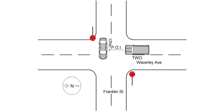
Vehicle One stated he was travelling Northbound on Waverley Ave when he collided with Vehicle Two. Vehicle One stated he did not know where Vehicle Two came from nor did he observe it prior to the collision. The operator of Vehicle One appeared shaken up due to airbag deployment but did not complain of any injuries. He was evaluated by Ambulance One and signed a patient refusal. Vehicle Two stated she was also driving Northbound on Waverley Ave when Vehicle One attempted to cross Waverley Ave from Franklin St causing the collision. The damage to both vehicles (Vehicle One drivers side damage and Vehicle Two front end damage) was consistent with Vehicle Two's version of the crash. Both vehicles were towed by AAA. The operator of Vehicle One was issued Mass Uniform Citation T1444379 for 89/9 Fail to Yield.
Keywords:
Airbag, Citation, Crash, Ems
Dcc:
Signs/Signals, Failed to yield
Report
url:
Image
url:
Latitude:
42.3492419
Longitude:
-71.1804564
Location:
Case
number:
Date:
2021-04-25
Time:
09:59
Address:
FRANKLIN ST & WAVERLEY AVE
Speed
limit:
25
Violation
cited:
no
Narrative:
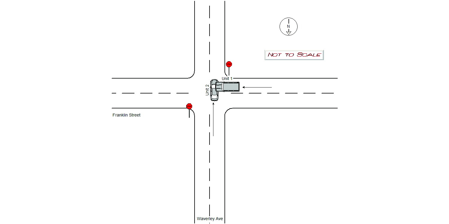
Oper of Veh # 1 stated she didn't see the stop sign while traveling EB on Franklin Street entering Waverley Ave. Oper of Veh # 2 stated he was traveling SB on Waverley Ave when a car just drove in to his passenger side while he crossing Franklin Street. Both vehicles where towed by Tody's. operator # 2 was transported to NWH by medics.
Keywords:
[]
Dcc:
Signs/Signals
Report
url:
Image
url:
Latitude:
42.3492419
Longitude:
-71.1804564
Location:
Advanced export
JSON shape: default, array, newline-delimited, object
CREATE TABLE "crash_reports" (
   [case_number] TEXT PRIMARY KEY,
   [datetime] TEXT,
   [date] TEXT,
   [time] TEXT,
   [address] INTEGER,
   [street1] TEXT,
   [street2] TEXT,
   [intersection] INTEGER,
   [speed_limit] INTEGER,
   [hit_run] INTEGER,
   [violation_cited] INTEGER,
   [narrative] TEXT,
   [keywords] TEXT,
   [dcc] TEXT,
   [dcc_code] TEXT,
   [report_url] TEXT,
   [image_url] TEXT
, [geocoded_address] TEXT, [latitude] TEXT, [longitude] TEXT, [manual_geocode] INTEGER, [retrieved] TEXT);