crash_reports
3 rows where date = "2021-11-03" and "retrieved" is on date 2021-11-16
This data as json, CSV (advanced)
Suggested facets: intersection, speed_limit, violation_cited, datetime (date), date (date), retrieved (date), keywords (array), dcc (array)
Case
number:
Date:
2021-11-03
Time:
02:34
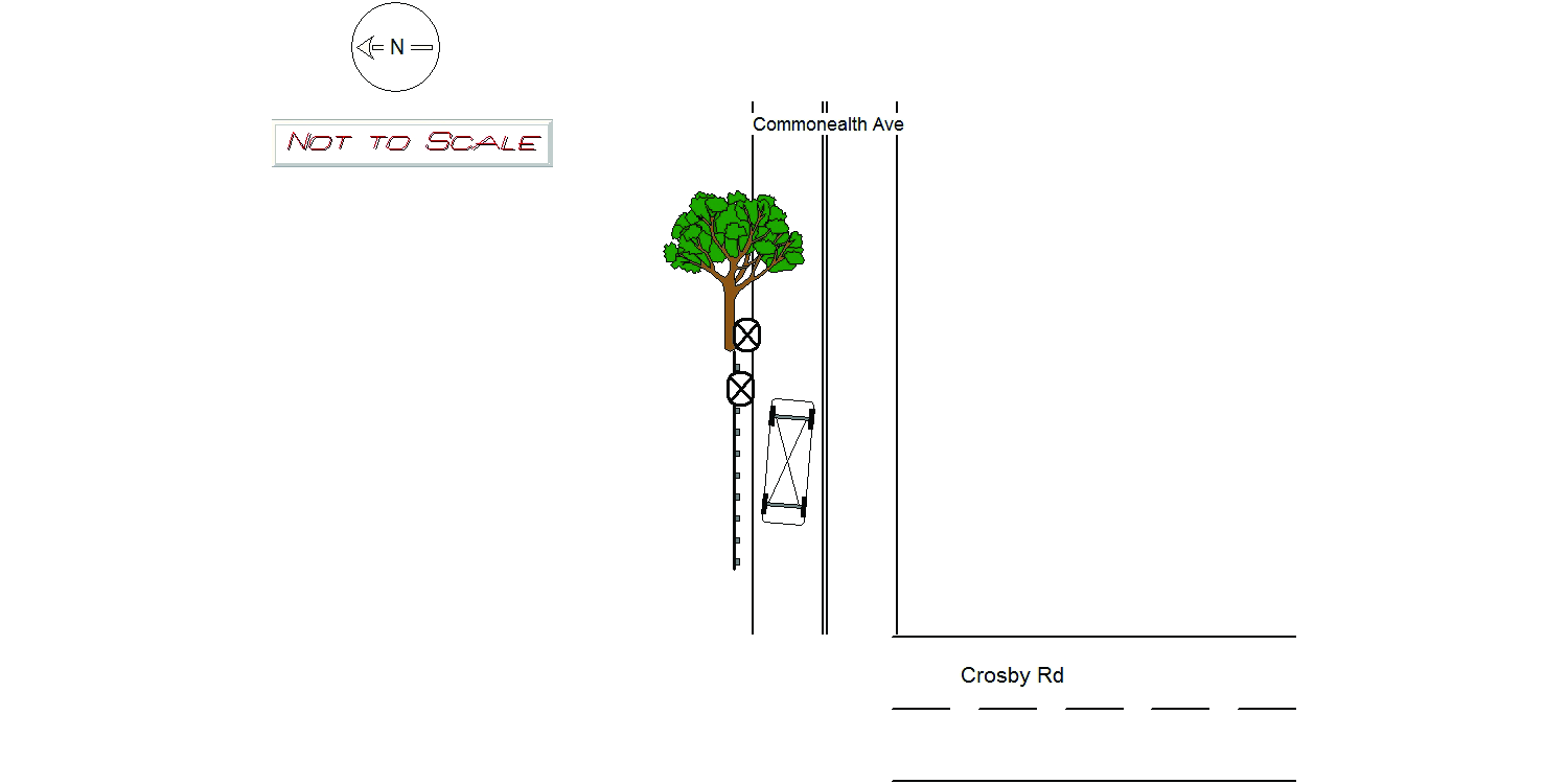
Address:
COMMONWEALTH AVE & CROSBY RD
Speed
limit:
35
Violation
cited:
yes
Narrative:
Upon arrival, vehicle 1 was rolled over and facing Eastbound in the Westbound lane. There was extensive damage all over the vehicle and it was leaking fluids. It appears that vehicle 1 was traveling Westbound on Commonwealth Ave and struck a tree and then crashed into the guard rail causing it to roll over. There was damage to a city tree and damage to the guard rail. Operator 1 stated (through translation from Officer Acuna), he was traveling Eastbound on Commonwealth Ave at approximately 25 MPH when he was looking at his GPS and his brakes gave out causing him to crash. When asked again, his story changed and he was not sure what direction he was traveling in. Newton Fire was able to retrieve operator 1's cell phone in the vehicle which was on a loop playing videos on instagram. Operator 1 was transported to Beth Israel Hospital by Fallon Ambulance. Tody's towed vehicle 1 and pictures were taken of the damage to city property and will be submitted to the IT Bureau to be attached to this report. Operator 1 was served in hand, Massachusetts Uniform Citation: T1445611 for the following: Ch. 89 s. 4A - Marked Lanes Violation Ch. 90 s.13B- Electronic Device Use While Operating a Motor Vehicle
Keywords:
Citation, Crash, Ems, Fire, Hospital, Phone, Pictures, Severe, Tree
Dcc:
Distracted
Report
url:
Image
url:
Latitude:
42.3372401
Longitude:
-71.1743446
Location:
Case
number:
Date:
2021-11-03
Time:
11:32
Address:
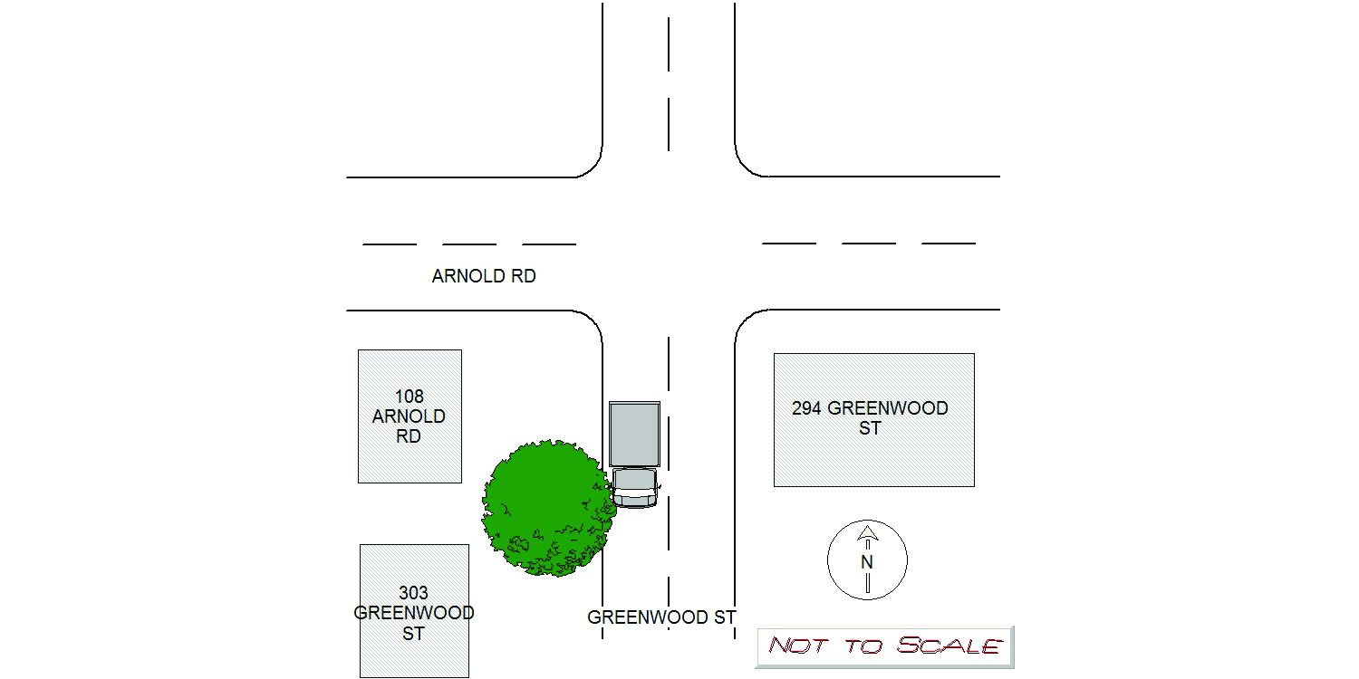
GREENWOOD ST & ARNOLD RD
Speed
limit:
25
Violation
cited:
no
Narrative:
On Wednesday at approximately 1132 hours while assigned to marked unit n499 I was dispatched to the intersection of Arnold Rd. and Greenwood Street for a report of a construction vehicle that took down a tree and was blocking the Road. Upon arrival I observed a large city tree on top of a box truck owned by 1-800-got junk completely blocking Greenwood Street. Newton Forestry responded to the scene and removed the tree from the vehicle and from the Road. Prior to the tree being cleared I spoke with the operator of the truck, SWEET Massimo, who states he was travelling Southbound on Greenwood Street toward Dedham Street when he attempted to pull to the side of the road. Prior to making it to the side of the road the top of the truck struck the city tree that was leaning over the roadway.tearing it from its roots and landing on top of the truck. My observations indicate that the tree would have been leaning over the roadway as SWEET's tires were still in the roadway when the tree was struck. SWEET states the vehicle has a dash camera that records and cold be accessed at a later date by the owner of the company. Five pictures were taken of the crash scene and emailed to policerecords@newtonma.gov.
Keywords:
Crash, Pictures, Tree
Dcc:
[]
Report
url:
Image
url:
Latitude:
42.3044666
Longitude:
-71.1909233
Location:
Case
number:
Date:
2021-11-03
Time:
11:03
Address:
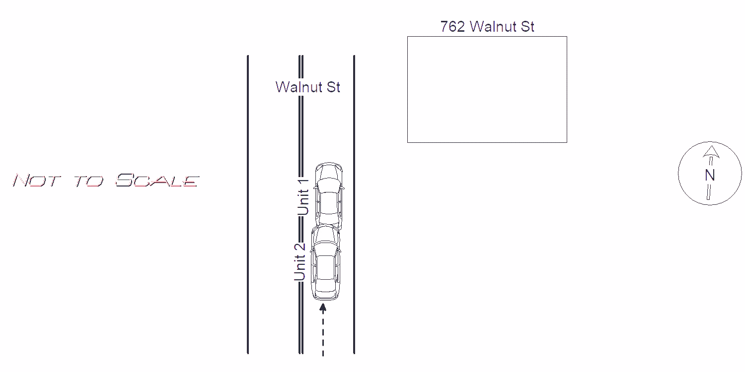
791 WALNUT ST
Speed
limit:
25
Violation
cited:
no
Narrative:
Mv#1 was travelling on Walnut St S/B in the area of #762, slowing to a stop. Mv#2 operator was travelling directly behind #1 and rear ended #1. #2 could not stop in time as traffic was slowing to a stop. #1 sustained significant rear end damage. #1 operator was shaken up from impact, signed a patient refusal and was able to drive the vehicle away. #2 also sustained significant front end damage, both side airbags were deployed. #2 operator was not injured, signed a patient refusal and #2 was towed By Tody's.
Keywords:
Airbag, Crash
Dcc:
Inattention
Report
url:
Image
url:
Latitude:
42.3347705
Longitude:
-71.2088333
Location:
Advanced export
JSON shape: default, array, newline-delimited, object
CREATE TABLE "crash_reports" (
   [case_number] TEXT PRIMARY KEY,
   [datetime] TEXT,
   [date] TEXT,
   [time] TEXT,
   [address] INTEGER,
   [street1] TEXT,
   [street2] TEXT,
   [intersection] INTEGER,
   [speed_limit] INTEGER,
   [hit_run] INTEGER,
   [violation_cited] INTEGER,
   [narrative] TEXT,
   [keywords] TEXT,
   [dcc] TEXT,
   [dcc_code] TEXT,
   [report_url] TEXT,
   [image_url] TEXT
, [geocoded_address] TEXT, [latitude] TEXT, [longitude] TEXT, [manual_geocode] INTEGER, [retrieved] TEXT);