crash_reports
1 row where date = "2022-06-07" and "retrieved" is on date 2022-06-14
This data as json, CSV (advanced)
Suggested facets: datetime (date), date (date), retrieved (date)
Case
number:
Date:
2022-06-07
Time:
12:30
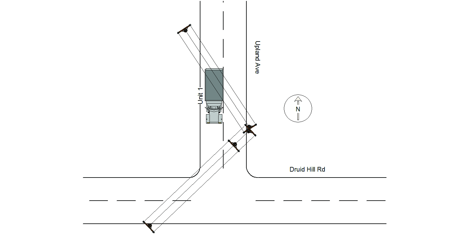
Address:
DRUID HILL RD & UPLAND AVE
Speed
limit:
25
Violation
cited:
no
Narrative:
On 06/07/2020 the operator of vehicle 1 was driving southbound on Upland Ave approaching Druid Hill Rd when the top of the truck caught a low hanging wire. As a result two utility poles were pulled from the ground and a third was damaged. The truck being operated was a Waste Management garbage truck which was contracted by the City of Newton. All utility companies were notified and responded. The operator of the truck reported no injuries and no damage to the vehicle. I took several digital images of the scene.
Keywords:
[]
Dcc:
[]
Report
url:
Image
url:
Latitude:
42.308097
Longitude:
-71.2047876
Location:
Advanced export
JSON shape: default, array, newline-delimited, object
CREATE TABLE "crash_reports" (
   [case_number] TEXT PRIMARY KEY,
   [datetime] TEXT,
   [date] TEXT,
   [time] TEXT,
   [address] INTEGER,
   [street1] TEXT,
   [street2] TEXT,
   [intersection] INTEGER,
   [speed_limit] INTEGER,
   [hit_run] INTEGER,
   [violation_cited] INTEGER,
   [narrative] TEXT,
   [keywords] TEXT,
   [dcc] TEXT,
   [dcc_code] TEXT,
   [report_url] TEXT,
   [image_url] TEXT
, [geocoded_address] TEXT, [latitude] TEXT, [longitude] TEXT, [manual_geocode] INTEGER, [retrieved] TEXT);