crash_reports
1 row where "date" is on date 2021-07-06, intersection = 0 and "retrieved" is on date 2021-07-15
This data as json, CSV (advanced)
Suggested facets: datetime (date), date (date), retrieved (date), keywords (array), dcc (array)
Case
number:
Date:
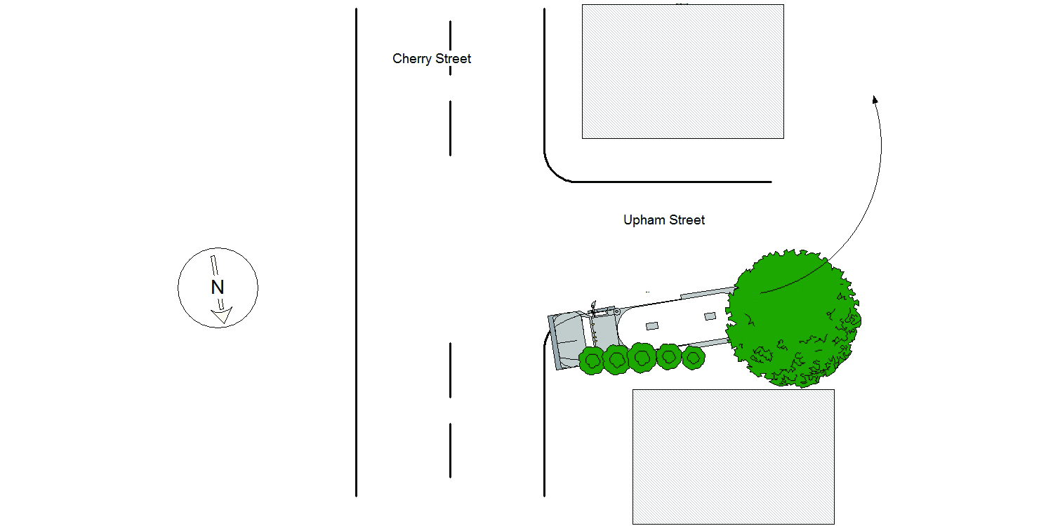
2021-07-06
Time:
07:28
Address:
289 CHERRY ST
Speed
limit:
25
Violation
cited:
no
Narrative:
Homeowners at #289 Cherry St., identified as Midge Connolly and Walter Devine called NPD to report that a delivery truck had driven on their property causing damage. On arrival I observed significant damage to the property at #289 Cherry St along the Upham St side of the property. Damage included the lawn, bushes between the driveway and Upham St, a tree and barrels. I then spoke with the operator of MV#1 who stated that while trying to back his truck into the driveway at #297 Cherry St, which is actually located on Upham St, he backed over the property at #289 Cherry St causing the damage listed above. No injuries, no tows and I took a few photographs of the damage to the property at #289 Cherry St.
Keywords:
Bus, Pictures, Tree
Dcc:
Improper turn
Report
url:
Image
url:
Latitude:
42.3544728
Longitude:
-71.228882
Location:
Advanced export
JSON shape: default, array, newline-delimited, object
CREATE TABLE "crash_reports" (
   [case_number] TEXT PRIMARY KEY,
   [datetime] TEXT,
   [date] TEXT,
   [time] TEXT,
   [address] INTEGER,
   [street1] TEXT,
   [street2] TEXT,
   [intersection] INTEGER,
   [speed_limit] INTEGER,
   [hit_run] INTEGER,
   [violation_cited] INTEGER,
   [narrative] TEXT,
   [keywords] TEXT,
   [dcc] TEXT,
   [dcc_code] TEXT,
   [report_url] TEXT,
   [image_url] TEXT
, [geocoded_address] TEXT, [latitude] TEXT, [longitude] TEXT, [manual_geocode] INTEGER, [retrieved] TEXT);