crash_reports
2 rows where "date" is on date 2021-07-06 and "retrieved" is on date 2021-07-15
This data as json, CSV (advanced)
Suggested facets: datetime (date), date (date), retrieved (date), keywords (array), dcc (array)
Case
number:
Date:
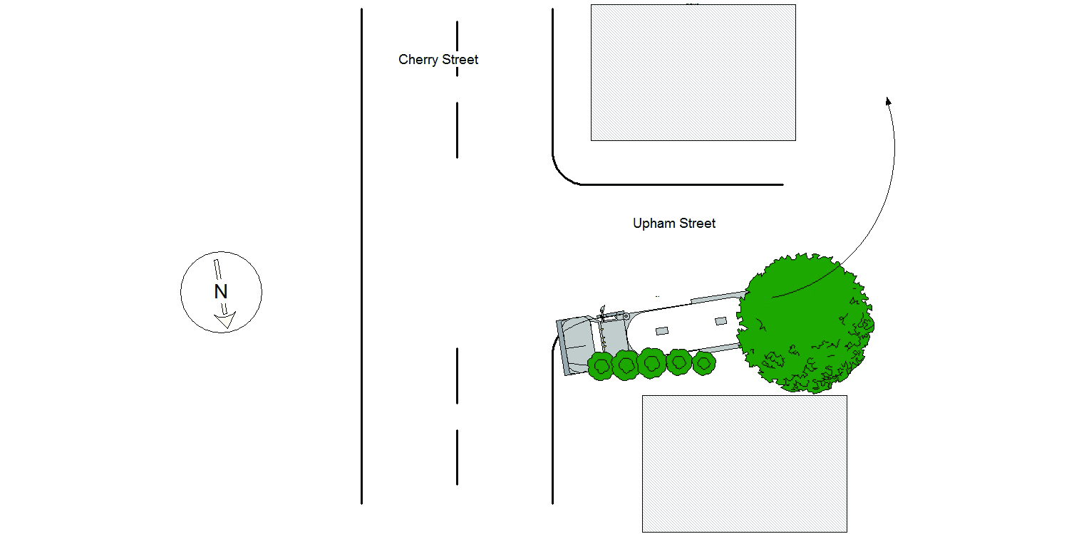
2021-07-06
Time:
07:28
Address:
289 CHERRY ST
Speed
limit:
25
Violation
cited:
no
Narrative:
Homeowners at #289 Cherry St., identified as Midge Connolly and Walter Devine called NPD to report that a delivery truck had driven on their property causing damage. On arrival I observed significant damage to the property at #289 Cherry St along the Upham St side of the property. Damage included the lawn, bushes between the driveway and Upham St, a tree and barrels. I then spoke with the operator of MV#1 who stated that while trying to back his truck into the driveway at #297 Cherry St, which is actually located on Upham St, he backed over the property at #289 Cherry St causing the damage listed above. No injuries, no tows and I took a few photographs of the damage to the property at #289 Cherry St.
Keywords:
Bus, Pictures, Tree
Dcc:
Improper turn
Report
url:
Image
url:
Latitude:
42.3544728
Longitude:
-71.228882
Location:
Case
number:
Date:
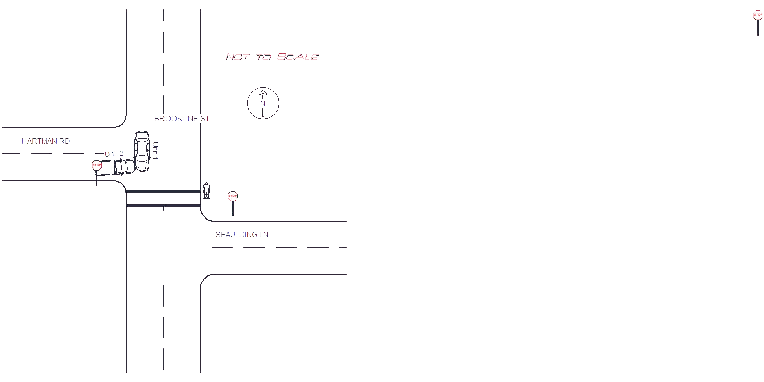
2021-07-06
Time:
12:54
Address:
BROOKLINE ST & HARTMAN RD
Speed
limit:
30
Violation
cited:
no
Narrative:
On Tuesday 7/6/21 at approx 1254 hrs, while assigned to N494, I responded to the intersection of Hartman Rd and Brookline St for a 2 car MVA. Operator of MV1 states she was coming from Boston heading SB on Brookline St when MV1 abruptly pulled out in front of her from Hartman Rd. Operator of MV2 states he stopped at the STOP sign at the end of Hartman Rd (Note Brookline St has no STOP signs at this intersection). He said he saw traffic on the NB side of Brookline St stopped and then attempted to take a left. He states that MV1 was going at a high rate of speed and did not have time to avoid the accident.
Keywords:
Crash, Speed
Dcc:
Failed to yield
Report
url:
Image
url:
Latitude:
42.3026959
Longitude:
-71.1765544
Location:
Advanced export
JSON shape: default, array, newline-delimited, object
CREATE TABLE "crash_reports" (
   [case_number] TEXT PRIMARY KEY,
   [datetime] TEXT,
   [date] TEXT,
   [time] TEXT,
   [address] INTEGER,
   [street1] TEXT,
   [street2] TEXT,
   [intersection] INTEGER,
   [speed_limit] INTEGER,
   [hit_run] INTEGER,
   [violation_cited] INTEGER,
   [narrative] TEXT,
   [keywords] TEXT,
   [dcc] TEXT,
   [dcc_code] TEXT,
   [report_url] TEXT,
   [image_url] TEXT
, [geocoded_address] TEXT, [latitude] TEXT, [longitude] TEXT, [manual_geocode] INTEGER, [retrieved] TEXT);