crash_reports
2 rows where "datetime" is on date 2021-01-26 and dcc_code = "[11]"
This data as json, CSV (advanced)
Suggested facets: datetime (date), date (date), retrieved (date), keywords (array), dcc (array)
Case
number:
Date:
2021-01-26
Time:
18:42
Address:
BOYLSTON ST & CHESTNUT ST
Speed
limit:
25
Violation
cited:
no
Narrative:
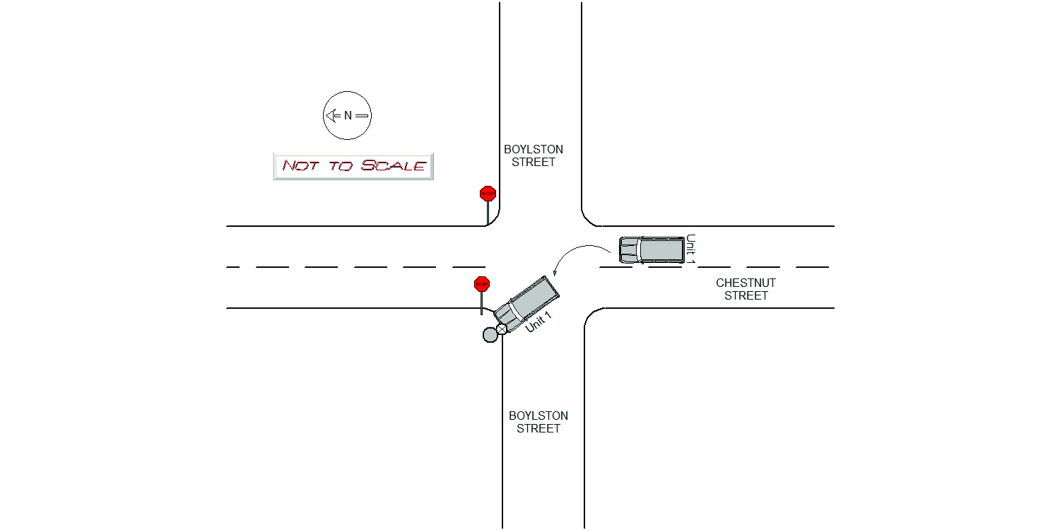
MV1 was traveling Northbound on Chestnut Street and was turning Westbound onto Boylston Street. While making the turn MV1 lost control due to the snow on the ground and crashed into telephone pole 153. There is damage to the front of MV1. There was no damage done to the pole.
Keywords:
Crash, Snow
Dcc:
Swerving
Report
url:
Image
url:
Latitude:
42.3169482
Longitude:
-71.2257627
Location:
Case
number:
Date:
2021-01-26
Time:
18:45
Address:
BOYLSTON ST & CHESTNUT ST
Speed
limit:
25
Violation
cited:
no
Narrative:
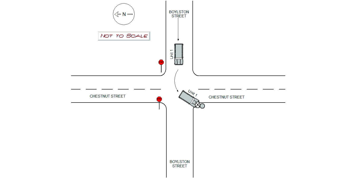
MV1 was traveling westbound on Boylston Street while attempting to turn Southbound on Chestnut Street. MV1 slid on the snow off the road and crashed into a State sign. There was damage to the front of MV1. MV1 damaged a State street sign located at the corner of Boylston Street and Chestnut Street. I took pictures of the damaged sign and delivered the SD card to IT to be attached to this report. The state was notified about the damage to their sign.
Keywords:
Crash, Pictures, Snow
Dcc:
Swerving
Report
url:
Image
url:
Latitude:
42.3169482
Longitude:
-71.2257627
Location:
Advanced export
JSON shape: default, array, newline-delimited, object
CREATE TABLE "crash_reports" (
   [case_number] TEXT PRIMARY KEY,
   [datetime] TEXT,
   [date] TEXT,
   [time] TEXT,
   [address] INTEGER,
   [street1] TEXT,
   [street2] TEXT,
   [intersection] INTEGER,
   [speed_limit] INTEGER,
   [hit_run] INTEGER,
   [violation_cited] INTEGER,
   [narrative] TEXT,
   [keywords] TEXT,
   [dcc] TEXT,
   [dcc_code] TEXT,
   [report_url] TEXT,
   [image_url] TEXT
, [geocoded_address] TEXT, [latitude] TEXT, [longitude] TEXT, [manual_geocode] INTEGER, [retrieved] TEXT);