crash_reports
3 rows where "datetime" is on date 2021-02-20 and hit_run = 1
This data as json, CSV (advanced)
Suggested facets: intersection, speed_limit, datetime (date), date (date), retrieved (date), keywords (array), dcc (array)
Case
number:
Date:
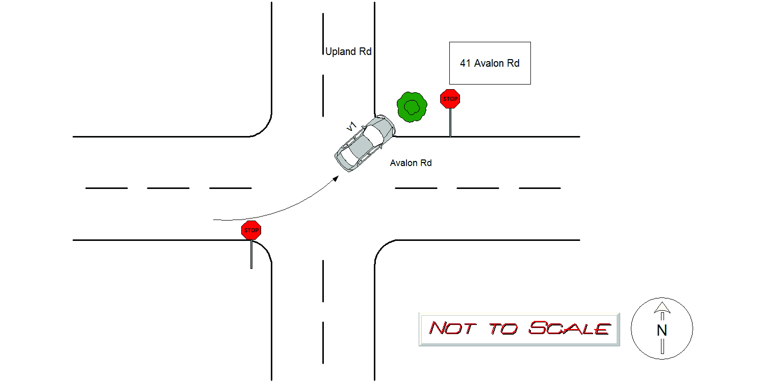
2021-02-20
Time:
05:16
Address:
41 AVALON RD
Speed
limit:
25
Violation
cited:
no
Narrative:
Vehicle 1 was travelling eastbound on Avalon Rd. Vehicle 1 travelled through the intersection of Avalon Rd and Upland Rd. Vehicle 1 crashed into the front lawn of 41 Avalon Rd. The operator was not on scene when I arrived. I went to the registered owner's house at 115 Upland Rd to investigate the accident, with negative results. The vehicle crashed during a snowstorm, and the party went back to his house for the evening. I observed moderate damage to the front of vehicle 1. The bushes on the homeowners front lawn were damaged. Todys towed the vehicle to their lot.
Keywords:
Bus, Crash, Moderate, Snow
Dcc:
Unknown
Report
url:
Image
url:
Latitude:
42.3291287
Longitude:
-71.2215959
Location:
Case
number:
Date:
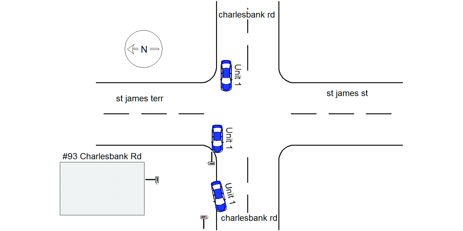
2021-02-20
Time:
09:04
Address:
CHARLESBANK RD & ST JAMES TERR
Speed
limit:
25
Violation
cited:
no
Narrative:
On February 20th, 2021 at approximately 09:04 hours while working N491 I responded to a report of a past hit&run MV crash that involved two US postal mailboxes that had been struck near the intersection of Charlesbank Rd @ St James Terrace. On my arrival to the scene I located the first mailbox on the sidewalk near #93 Charlesbank Rd. The other mailbox was located on the property to #93 Charlesbank Rd upside down leaning up against the front of the house. Dispatch notified the postal authorities and they were going to respond to pick up their mailboxes. The vehicle involved in this MV crash appeared to be a Subaru based on the vehicles damaged parts found at the scene. The vehicle left scene heading W/B on Charlesbank Rd. #94 Charlesbank heard a loud noise around 01:15 this morning but thought it eas just a plow.
Keywords:
Crash
Dcc:
Reckless driving
Report
url:
Image
url:
Latitude:
42.3587668
Longitude:
-71.1802241
Location:
Case
number:
Date:
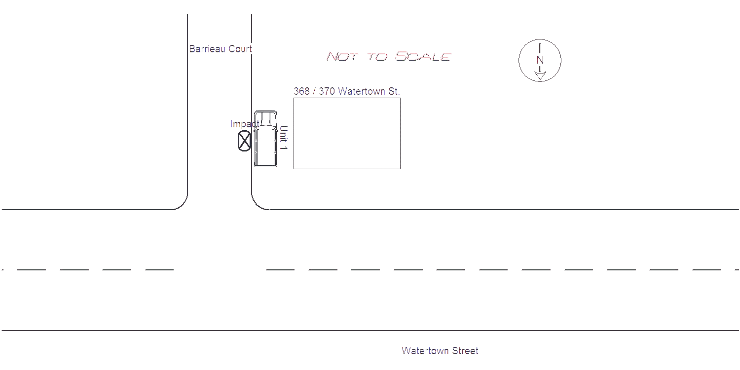
2021-02-20
Time:
11:40
Address:
WATERTOWN ST & BARRIEAU COURT
Speed
limit:
15
Violation
cited:
no
Narrative:
Owner of Veh 1 stated that he believes his car was struck around 4:30 earlier this morning, when he heard a loud noise. His vehicle was parked on Barrieau Court next to 368 Watertown Street. Damage makes owner believe it was hit by a plow during the snow storm. No cameras were located in the area. Owner may call for a tow later due to damage. Owner contacted me to let know that Antonellis Construction plows the area.
Keywords:
Snow
Dcc:
[]
Report
url:
Image
url:
Latitude:
42.3585632
Longitude:
-71.204393
Location:
Advanced export
JSON shape: default, array, newline-delimited, object
CREATE TABLE "crash_reports" (
   [case_number] TEXT PRIMARY KEY,
   [datetime] TEXT,
   [date] TEXT,
   [time] TEXT,
   [address] INTEGER,
   [street1] TEXT,
   [street2] TEXT,
   [intersection] INTEGER,
   [speed_limit] INTEGER,
   [hit_run] INTEGER,
   [violation_cited] INTEGER,
   [narrative] TEXT,
   [keywords] TEXT,
   [dcc] TEXT,
   [dcc_code] TEXT,
   [report_url] TEXT,
   [image_url] TEXT
, [geocoded_address] TEXT, [latitude] TEXT, [longitude] TEXT, [manual_geocode] INTEGER, [retrieved] TEXT);