crash_reports
2 rows where "datetime" is on date 2021-09-27, dcc contains "Followed too closely" and intersection = 0
This data as json, CSV (advanced)
Suggested facets: datetime (date), date (date), retrieved (date), keywords (array), dcc (array)
Case
number:
Date:
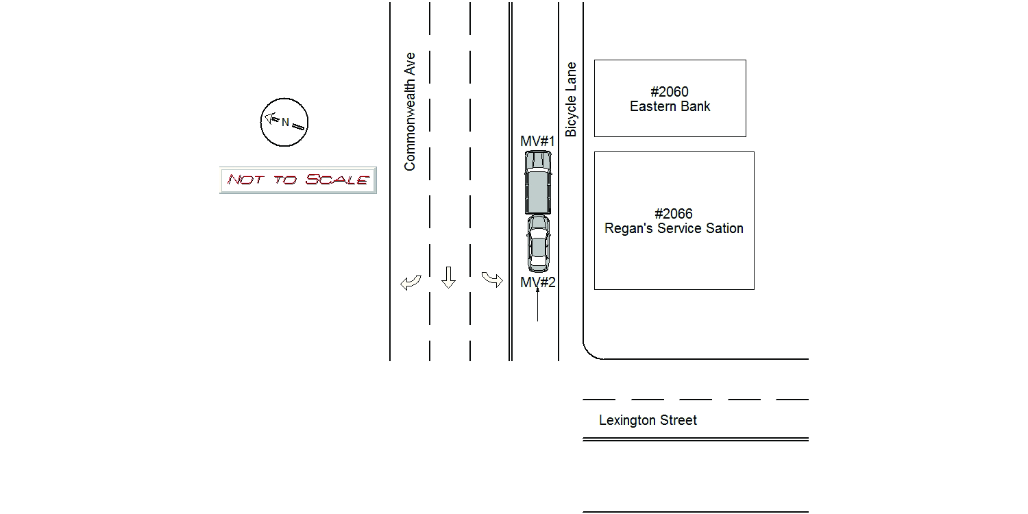
2021-09-27
Time:
15:42
Address:
2066 COMMONWEALTH AVE
Speed
limit:
25
Violation
cited:
no
Narrative:
The OP. of MV#1 stated while traveling eastbound on Commonwealth Ave., she slowed down to a stop due to heavy traffic. She was then suddenly rear ended by MV#2. The OP. of MV#2 stated while traveling eastbound on Commonwealth Ave., MV#1 in front of her suddenly came to a stop. She couldn't brake in time and collided into the rear of MV#1.
Keywords:
[]
Dcc:
Followed too closely
Report
url:
Image
url:
Latitude:
42.3476056
Longitude:
-71.2467022
Location:
Case
number:
Date:
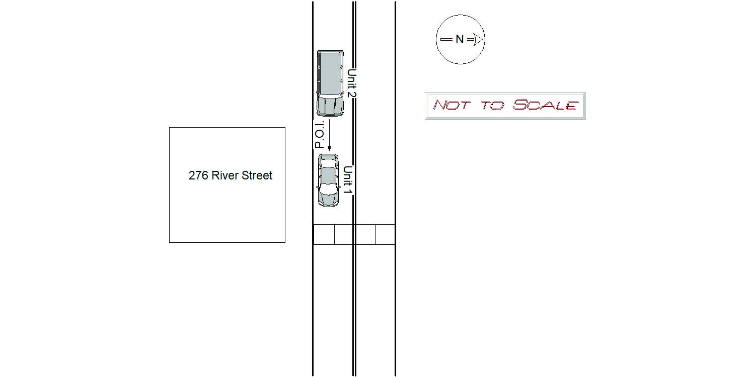
2021-09-27
Time:
15:35
Address:
276 RIVER ST
Speed
limit:
25
Violation
cited:
yes
Narrative:
Operator 1 states he was operating MV1 east on River Street. Operator 1 stated he had to stop quickly for pedestrians in the cross walk at 276 River Street. At this time MV2 crashed into the rear of MV1. The operator of MV2 states he was traveling east on River Street when MV1 stopped abruptly in front of him and he crashed into MV1. The operator of MV2 stated he witnessed the operator driving MV1 and the operator of MV1 stated he was operating MV1 which is registered to him. When I arrived on scene both vehicles where facing east on River Street. The keys were in the ignition of MV1 and it was still running. River Street is a public way in the City of Newton. No reported injuries. MV1 was towed from the scene. Citation issued to Operator of MV1 for MGL 90/10 no license.
Keywords:
Citation, Crash, Ped, Walk
Dcc:
Followed too closely
Report
url:
Image
url:
Latitude:
42.3562172
Longitude:
-71.2371959
Location:
Advanced export
JSON shape: default, array, newline-delimited, object
CREATE TABLE "crash_reports" (
   [case_number] TEXT PRIMARY KEY,
   [datetime] TEXT,
   [date] TEXT,
   [time] TEXT,
   [address] INTEGER,
   [street1] TEXT,
   [street2] TEXT,
   [intersection] INTEGER,
   [speed_limit] INTEGER,
   [hit_run] INTEGER,
   [violation_cited] INTEGER,
   [narrative] TEXT,
   [keywords] TEXT,
   [dcc] TEXT,
   [dcc_code] TEXT,
   [report_url] TEXT,
   [image_url] TEXT
, [geocoded_address] TEXT, [latitude] TEXT, [longitude] TEXT, [manual_geocode] INTEGER, [retrieved] TEXT);