crash_reports
3 rows where dcc = "["Unknown"]", intersection = 0 and "retrieved" is on date 2021-02-19
This data as json, CSV (advanced)
Suggested facets: date, hit_run, datetime (date), date (date), retrieved (date), keywords (array), dcc (array)
Case
number:
Date:
2021-02-07
Time:
14:04
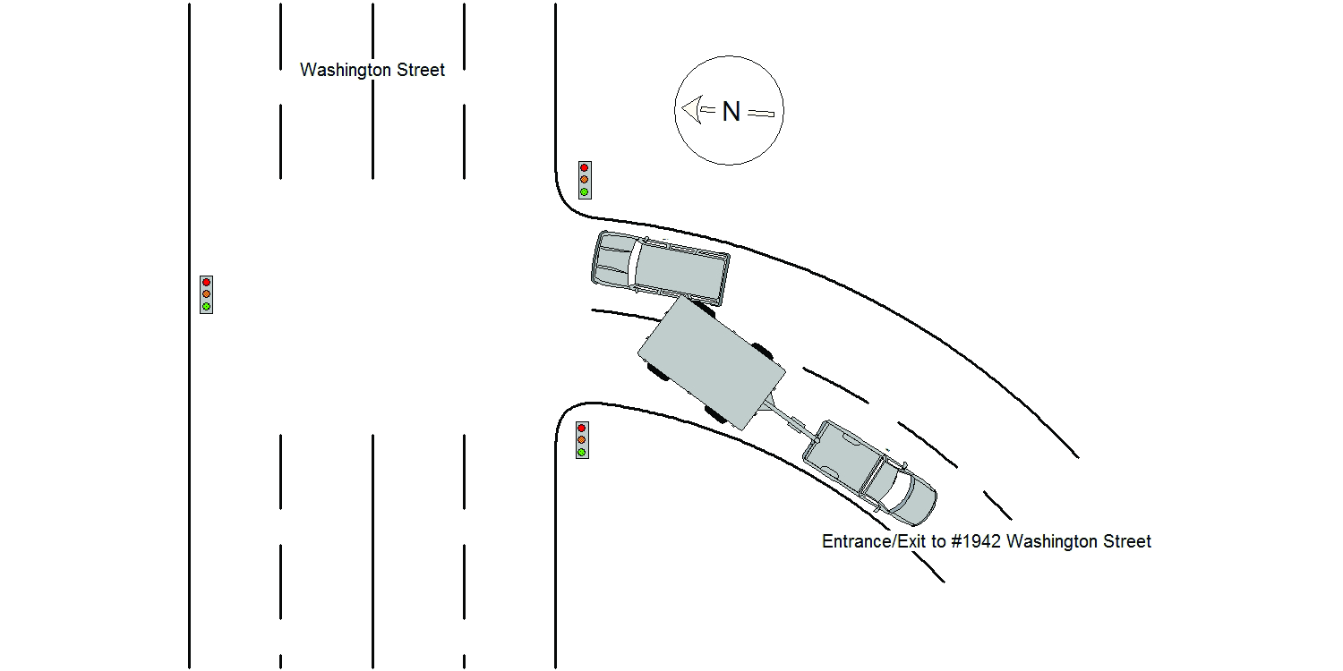
Address:
1946 WASHINGTON ST
Speed
limit:
25
Violation
cited:
no
Narrative:
The operator of MV#1 stated that she was attempting to exit #1946 Washington St. and that her MV was stopped at the red light to enter Washington St when her MV was struck by MV#2. MV#2 was traveling east on Washington St and attempting to turn right into #1946 Washington St when his MV began to slide on the new snow on the roadway and struck MV#1. No injuries, no tows.
Keywords:
Snow
Dcc:
Unknown
Report
url:
Image
url:
Latitude:
42.3325996
Longitude:
-71.242162
Location:
Case
number:
Date:
2021-02-07
Time:
14:53
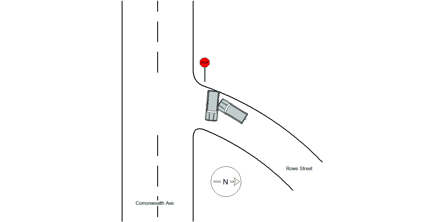
Address:
135 ROWE ST
Speed
limit:
25
Violation
cited:
no
Narrative:
The operator of MV#1 stated that he was traveling south on Rowe St approaching Commonwealth Ave when MV#2 slid on the new snow cover road and crashed into MV#1. The operator of MV#2 stated that he has just turned onto Rowe St from Commonwealth Ave when his MV slid on the snow covered road into MV#1. No injuries, no tows.
Keywords:
Crash, Snow
Dcc:
Unknown
Report
url:
Image
url:
Latitude:
42.3477896
Longitude:
-71.2431753
Location:
Case
number:
Date:
2021-02-09
Time:
11:06
Address:
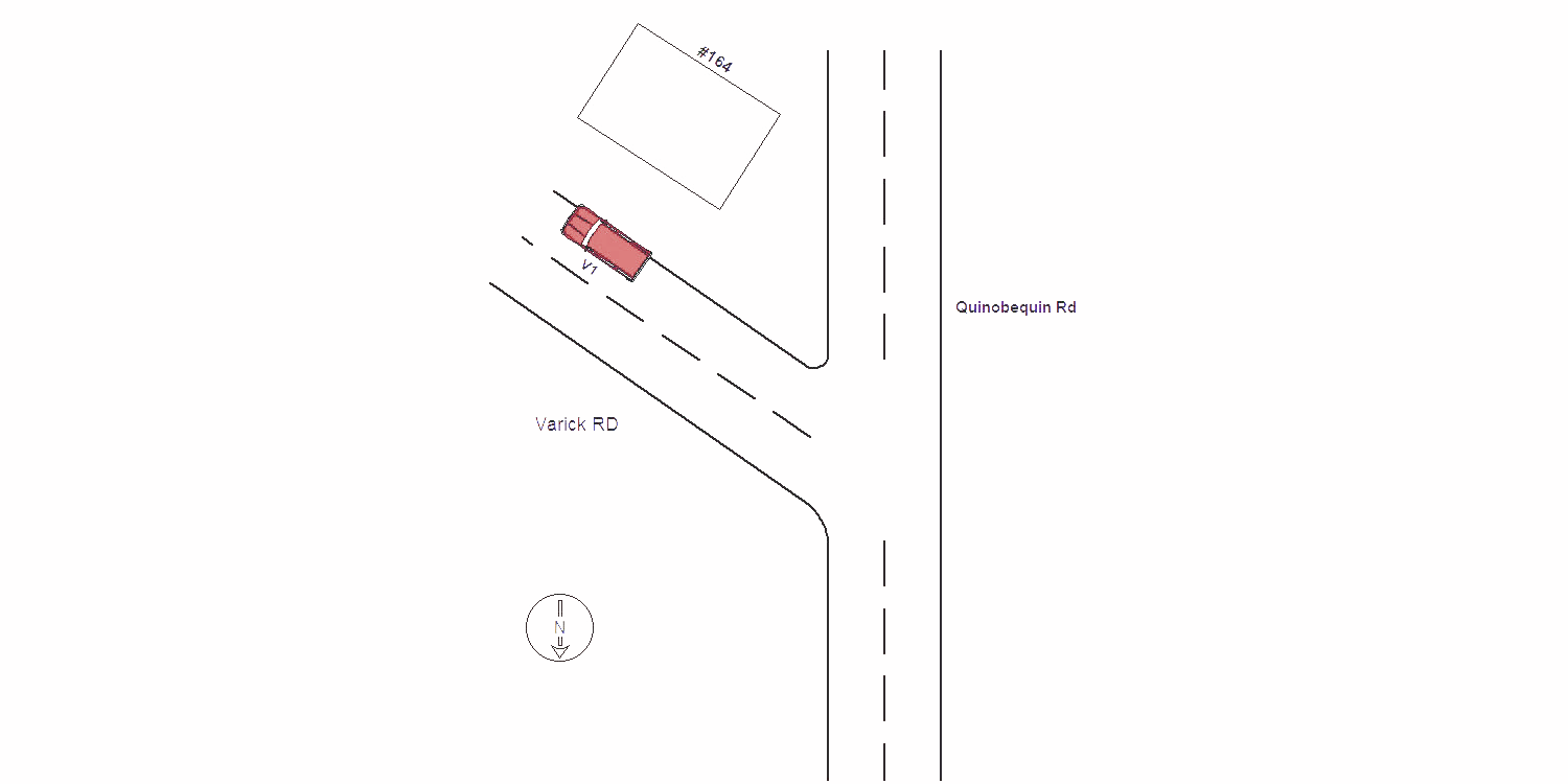
164 VARICK RD
Speed
limit:
25
Violation
cited:
no
Narrative:
I responded to the area of Varick Rd@Quinobequin Rd. on 02/09/2021 at approx. 1106 hrs for a report of a past MVA/HR. I arrived in the area and was flagged down by vehicle owner De-Souza, Fernanda MA OLN#S64319275. She was with her vehicle MA Reg. 7115ZS; 2016 Niss/Murano color Red. The vehicle was parked on Varick Rd. directly in front of #164 Varick Rd. The vehicle had visible damage all along the drivers side which was facing the street. The vehicle appeared to have been sideswiped (probably by a plow truck). According to De-Souza the vehicle was parked unoccupied since approximately 0900 hrs to present. The MVA was unwitnessed and as of the time of this report no witnesses have been identified. The vehicle sustained body damage along the full length of the drivers side. The vehicle did not require towing service. De-Sousza has been advised to contact her insurance co. and a MVA report would be documented.
Keywords:
[]
Dcc:
Unknown
Report
url:
Image
url:
Latitude:
42.3246288
Longitude:
-71.2446111
Location:
Advanced export
JSON shape: default, array, newline-delimited, object
CREATE TABLE "crash_reports" (
   [case_number] TEXT PRIMARY KEY,
   [datetime] TEXT,
   [date] TEXT,
   [time] TEXT,
   [address] INTEGER,
   [street1] TEXT,
   [street2] TEXT,
   [intersection] INTEGER,
   [speed_limit] INTEGER,
   [hit_run] INTEGER,
   [violation_cited] INTEGER,
   [narrative] TEXT,
   [keywords] TEXT,
   [dcc] TEXT,
   [dcc_code] TEXT,
   [report_url] TEXT,
   [image_url] TEXT
, [geocoded_address] TEXT, [latitude] TEXT, [longitude] TEXT, [manual_geocode] INTEGER, [retrieved] TEXT);