crash_reports
3 rows where dcc = "["Visibility obstructed"]" and speed_limit = 10
This data as json, CSV (advanced)
Suggested facets: keywords, dcc_code, datetime (date), date (date), retrieved (date), keywords (array), dcc (array)
Case
number:
Date:
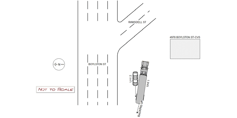
2019-01-11
Time:
11:10
Address:
978 BOYLSTON ST
Speed
limit:
10
Violation
cited:
no
Narrative:
Veh #1 is a semi-trailer and was attempting to back up in the parking lot of #978 Boylston St-CVS when it collided with veh # 2. No damage to veh #1 Veh #2 stated he was attempting to go around veh #1 in the parking lot when veh #1 backed into him. Damage to veh #2 rear drivers side door.
Keywords:
[]
Dcc:
Visibility obstructed
Report
url:
Image
url:
Latitude:
42.3181167
Longitude:
-71.211237
Location:
Case
number:
Date:
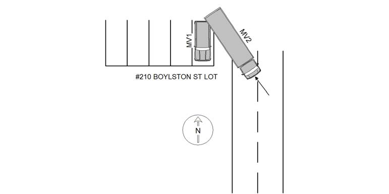
2019-06-10
Time:
11:57
Address:
210 BOYLSTON ST LOT
Speed
limit:
10
Violation
cited:
no
Narrative:
OPER OF MV#1 STATED THAT WHILE PARKED (#210 BOYLSTON ST LOT), MV#2 REVERSED INTO HER VEHICLE CAUSING MODERATE REAR DAMAGE. OPER OF MV#2 STATED THAT HE WAS BACKING HIS TRUCK UP, AND DID NOT SEE MV#1 PARKED. MV#2 (REAR) COLLIDED WITH THE REAR OF MV#1. MV#2 SUSTAINED MINOR REAR PAINT TRANSFER.
Keywords:
Moderate
Dcc:
Visibility obstructed
Report
url:
Image
url:
Latitude:
42.3187649
Longitude:
-71.1759039
Location:
Case
number:
Date:
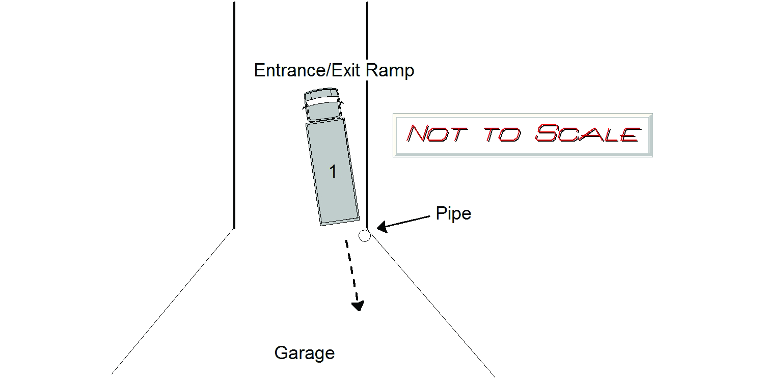
2022-04-22
Time:
15:22
Address:
HAMMOND POND PKWY
Speed
limit:
10
Violation
cited:
no
Narrative:
While turning around in the parking garage at The Towers of Chestnut Hill at 250 Hammond Pond Pkwy, Vehicle 1 backed into a drainpipe for the building's sprinkler system causing minor damage to the pipe. On 5/2/22 staff at the Towers provided security footage confirming that Vehicle 1 had caused the damage.
Keywords:
[]
Dcc:
Visibility obstructed
Report
url:
Image
url:
Latitude:
42.3214194
Longitude:
-71.1723739
Location:
Advanced export
JSON shape: default, array, newline-delimited, object
CREATE TABLE "crash_reports" (
   [case_number] TEXT PRIMARY KEY,
   [datetime] TEXT,
   [date] TEXT,
   [time] TEXT,
   [address] INTEGER,
   [street1] TEXT,
   [street2] TEXT,
   [intersection] INTEGER,
   [speed_limit] INTEGER,
   [hit_run] INTEGER,
   [violation_cited] INTEGER,
   [narrative] TEXT,
   [keywords] TEXT,
   [dcc] TEXT,
   [dcc_code] TEXT,
   [report_url] TEXT,
   [image_url] TEXT
, [geocoded_address] TEXT, [latitude] TEXT, [longitude] TEXT, [manual_geocode] INTEGER, [retrieved] TEXT);