crash_reports
3 rows where dcc contains "Swerving" and speed_limit = 20
This data as json, CSV (advanced)
Suggested facets: intersection, dcc, dcc_code, datetime (date), date (date), retrieved (date), keywords (array), dcc (array)
Case
number:
Date:
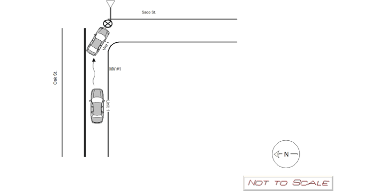
2019-12-01
Time:
18:16
Address:
OAK ST.
Speed
limit:
20
Violation
cited:
no
Narrative:
MV#1 was traveling southbound on Oak St. Due to the snowy, wet conditions MV#1 lost traction with the roadway and skidded into the Saco St. sign. Damage was observed to the driver side front bumper of MV#1. No injuries were reported and MV#1 was able to be driven from the scene. The Saco St. sign was damaged and left on the side of the road. The city of Newton Public Works Deptartment was notified about the damage to the sign and photos of the damage were given to the Newton Police IT Bureau.
Keywords:
Pictures, Snow
Dcc:
Swerving
Report
url:
Image
url:
Latitude:
42.3096255
Longitude:
-71.2205779
Location:
Case
number:
Date:
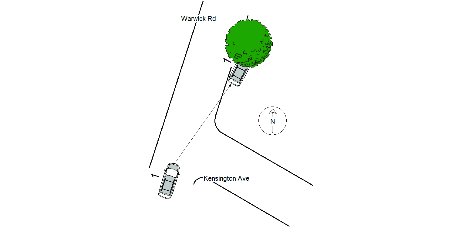
2021-02-16
Time:
01:19
Address:
135 WARWICK RD
Speed
limit:
20
Violation
cited:
no
Narrative:
The operator of Vehicle #1 stated that as he was travelling Northbound on Warwick Rd he lost control of his vehicle in the ice and collided with the tree. The vehicle sustained front end damage. The operator declined medical attention when it was offered.
Keywords:
Ice, Tree
Dcc:
Too fast for conditions, Swerving
Report
url:
Image
url:
Latitude:
42.3559213
Longitude:
-71.2171338
Location:
Case
number:
Date:
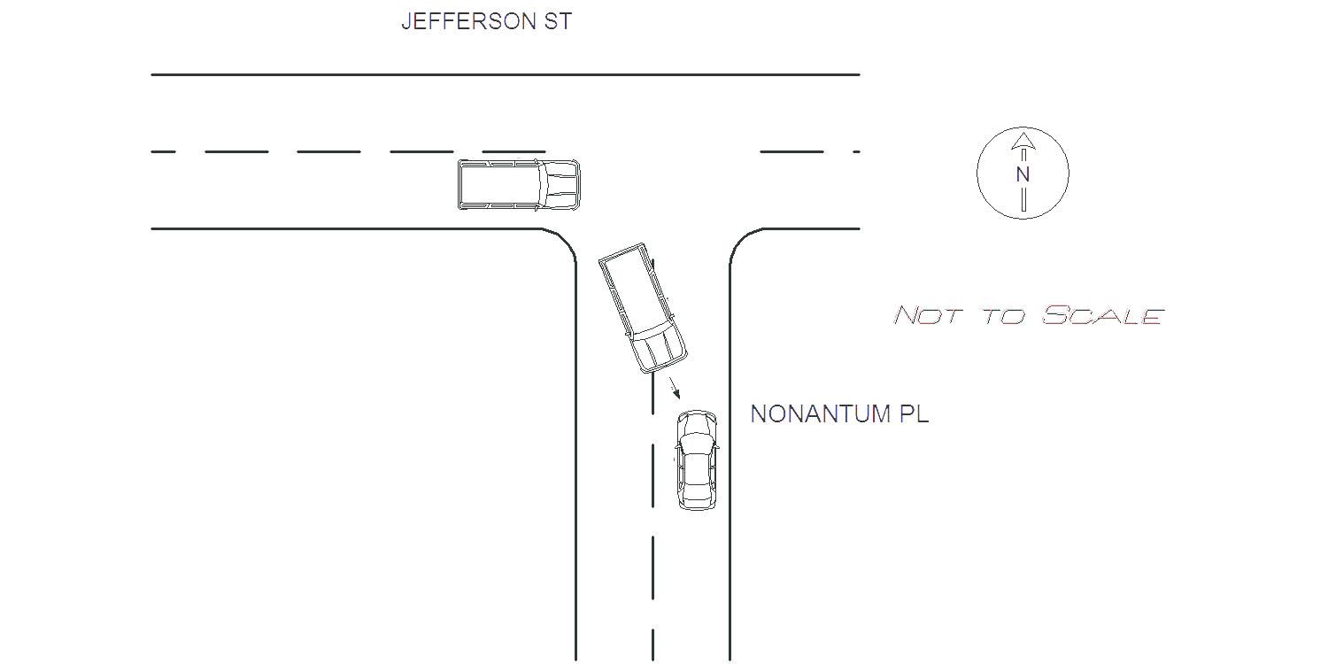
2022-01-25
Time:
07:57
Address:
NONANTUM PL & JEFFERSON ST
Speed
limit:
20
Violation
cited:
no
Narrative:
OPERATOR OF MV STATED SHE WAS TURNING ONTO NONANTUM PL FROM JEFFERSON ST AND DUE TO THE SNOW ON THE ROAD, HER VEHICLE SLID INTO MV 2'S FRONT END . NO INJURIES FOR MV 1 AND MINOR DAMAGE. OPERATOR OF MV 2 STATED HE WAS TRAVELING ON NONANTUM PL WHEN MV1 LOST CONTROL DUE TO THE ROAD CONDITIONS AND SLID INTO HIS VEHICLE. MINOR DAMAGE SUSTAINED TO MV 2 AND THE OPERATOR WAS TRANSPORTED TO NWH FOR BACK PAIN.
Keywords:
Snow
Dcc:
Swerving
Report
url:
Image
url:
Latitude:
42.358931
Longitude:
-71.1830475
Location:
Advanced export
JSON shape: default, array, newline-delimited, object
CREATE TABLE "crash_reports" (
   [case_number] TEXT PRIMARY KEY,
   [datetime] TEXT,
   [date] TEXT,
   [time] TEXT,
   [address] INTEGER,
   [street1] TEXT,
   [street2] TEXT,
   [intersection] INTEGER,
   [speed_limit] INTEGER,
   [hit_run] INTEGER,
   [violation_cited] INTEGER,
   [narrative] TEXT,
   [keywords] TEXT,
   [dcc] TEXT,
   [dcc_code] TEXT,
   [report_url] TEXT,
   [image_url] TEXT
, [geocoded_address] TEXT, [latitude] TEXT, [longitude] TEXT, [manual_geocode] INTEGER, [retrieved] TEXT);