crash_reports
2 rows where dcc contains "Visibility obstructed", hit_run = 0 and speed_limit = 5
This data as json, CSV (advanced)
Suggested facets: datetime (date), date (date), retrieved (date), dcc (array)
Case
number:
Date:
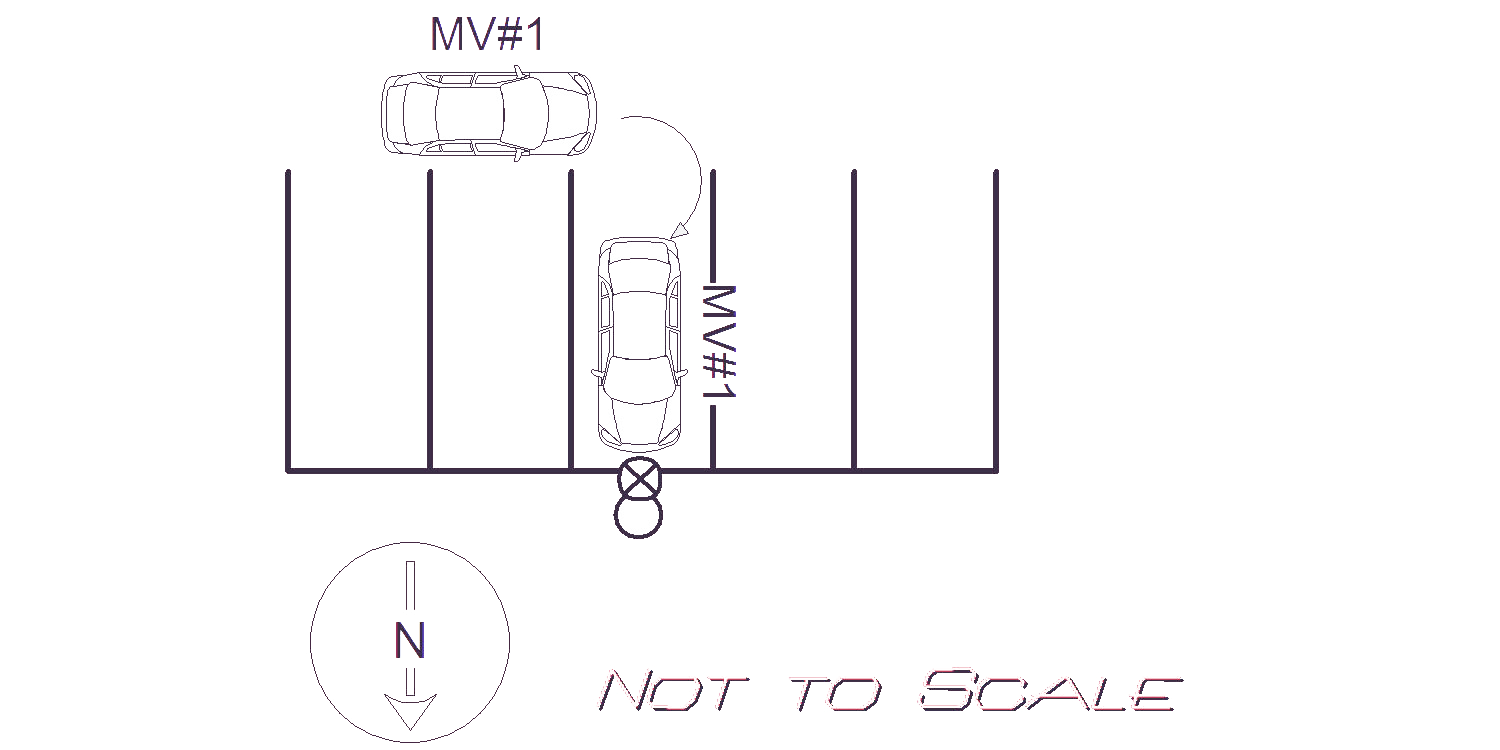
2021-08-23
Time:
21:52
Address:
2040 COMMONWEALTH AVE
Speed
limit:
5
Violation
cited:
no
Narrative:
MV#1 Was dropping off a passenger from his Lyft vehicle when he struck a pole in the parking lot of the Star Market located at 2040 Commonwealth Ave. OPMV#1 Stated after he dropped the passenger off he attempted to drive away and didn't see the pole because it was in his blind spot. Vehicle was towed.
Keywords:
[]
Dcc:
Visibility obstructed, Inattention
Report
url:
Image
url:
Latitude:
42.3469722
Longitude:
-71.2448227
Location:
Case
number:
Date:
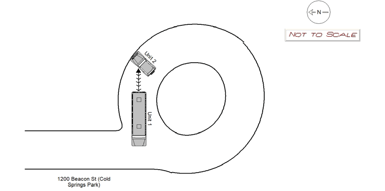
2021-09-29
Time:
17:31
Address:
1200 BEACON ST
Speed
limit:
5
Violation
cited:
no
Narrative:
Operator of MV1 states he was backing up MV1 when he struck MV2, which was in his blind spot. MV2 was parked and unoccupied. Very minor damage to MV1 rear bumper. MV2 sustained damage to the left driver's side door. No injuries.
Keywords:
[]
Dcc:
Visibility obstructed
Report
url:
Image
url:
Latitude:
42.3311133
Longitude:
-71.2132723
Location:
Advanced export
JSON shape: default, array, newline-delimited, object
CREATE TABLE "crash_reports" (
   [case_number] TEXT PRIMARY KEY,
   [datetime] TEXT,
   [date] TEXT,
   [time] TEXT,
   [address] INTEGER,
   [street1] TEXT,
   [street2] TEXT,
   [intersection] INTEGER,
   [speed_limit] INTEGER,
   [hit_run] INTEGER,
   [violation_cited] INTEGER,
   [narrative] TEXT,
   [keywords] TEXT,
   [dcc] TEXT,
   [dcc_code] TEXT,
   [report_url] TEXT,
   [image_url] TEXT
, [geocoded_address] TEXT, [latitude] TEXT, [longitude] TEXT, [manual_geocode] INTEGER, [retrieved] TEXT);