crash_reports
2 rows where "retrieved" is on date 2021-07-15 and speed_limit = 25
This data as json, CSV (advanced)
Suggested facets: datetime (date), date (date), retrieved (date), keywords (array), dcc (array)
Case
number:
Date:
2021-07-06
Time:
07:28
Address:
289 CHERRY ST
Speed
limit:
25
Violation
cited:
no
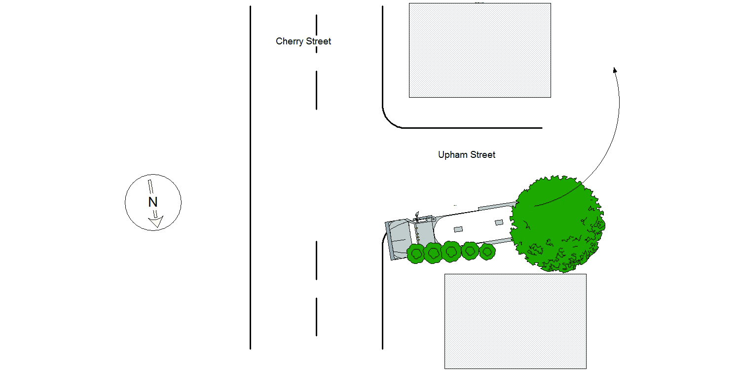
Narrative:
Homeowners at #289 Cherry St., identified as Midge Connolly and Walter Devine called NPD to report that a delivery truck had driven on their property causing damage. On arrival I observed significant damage to the property at #289 Cherry St along the Upham St side of the property. Damage included the lawn, bushes between the driveway and Upham St, a tree and barrels. I then spoke with the operator of MV#1 who stated that while trying to back his truck into the driveway at #297 Cherry St, which is actually located on Upham St, he backed over the property at #289 Cherry St causing the damage listed above. No injuries, no tows and I took a few photographs of the damage to the property at #289 Cherry St.
Keywords:
Bus, Pictures, Tree
Dcc:
Improper turn
Report
url:
Image
url:
Latitude:
42.3544728
Longitude:
-71.228882
Location:
Case
number:
Date:
2021-07-07
Time:
09:55
Address:
320 WASHINGTON ST
Speed
limit:
25
Violation
cited:
no
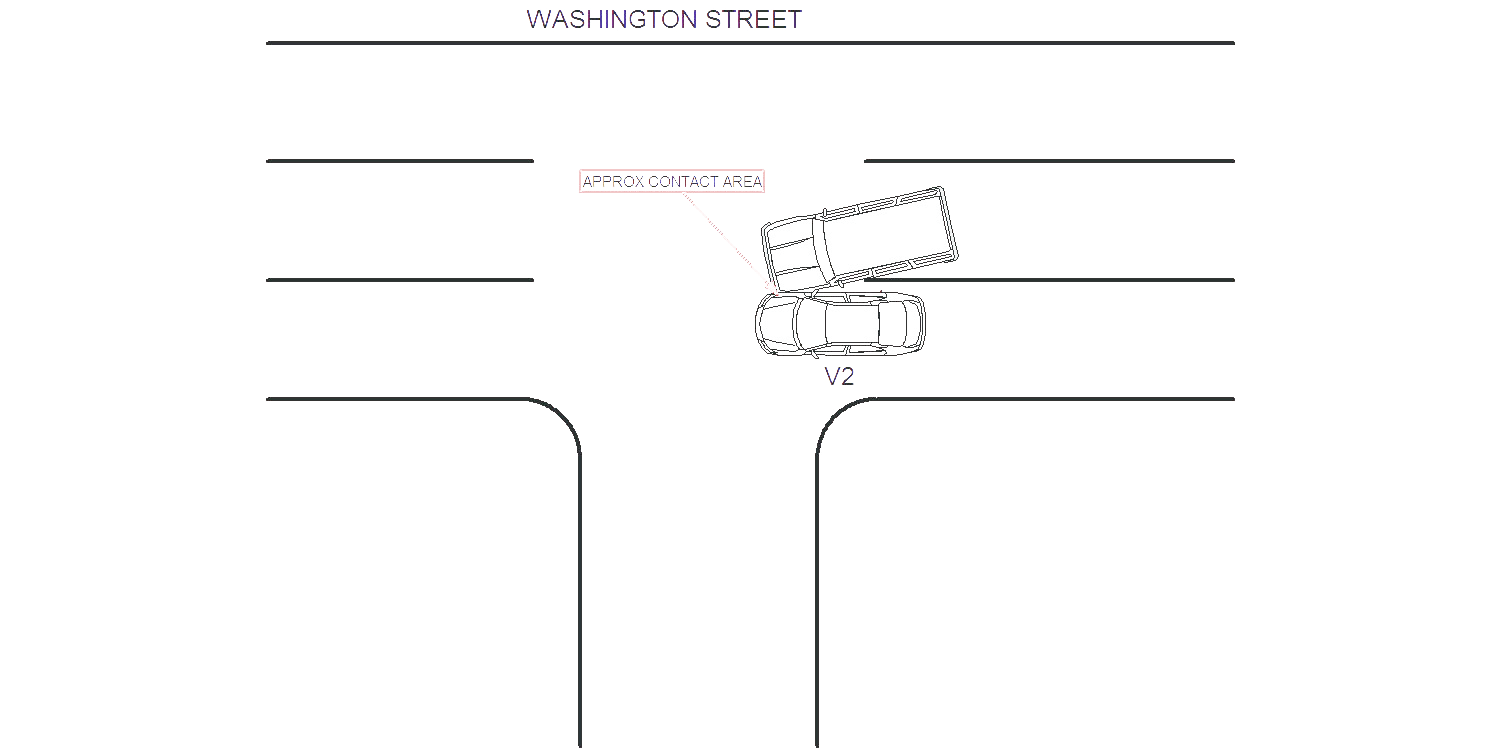
Narrative:
Oper V1 stated she was traveling west on Washington Street in the middle lane with her left turn signal activated, to turn into 320 Washington Street entrance ( Four Points Hotel). She stated while turning left, V2 sped up and had contact with V2. Oper V2 stated he was traveling west on Washington Street in the left lane, he observed V1 with signal on but her vehicle turned into his vehicle in his lane. There was no reported injuries, both vehicles were towed by Todys towing. All parties advised of accident reporting process.
Keywords:
Crash
Dcc:
Unknown
Report
url:
Image
url:
Latitude:
42.3563932
Longitude:
-71.1872752
Location:
Advanced export
JSON shape: default, array, newline-delimited, object
CREATE TABLE "crash_reports" (
   [case_number] TEXT PRIMARY KEY,
   [datetime] TEXT,
   [date] TEXT,
   [time] TEXT,
   [address] INTEGER,
   [street1] TEXT,
   [street2] TEXT,
   [intersection] INTEGER,
   [speed_limit] INTEGER,
   [hit_run] INTEGER,
   [violation_cited] INTEGER,
   [narrative] TEXT,
   [keywords] TEXT,
   [dcc] TEXT,
   [dcc_code] TEXT,
   [report_url] TEXT,
   [image_url] TEXT
, [geocoded_address] TEXT, [latitude] TEXT, [longitude] TEXT, [manual_geocode] INTEGER, [retrieved] TEXT);